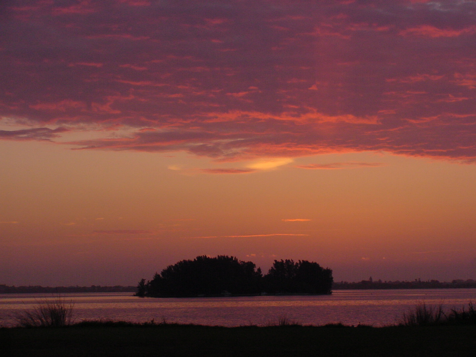
The body of water that runs along the doorstep of Fort Pierce, Florida, is not a river at all. The Indian River Lagoon is a narrow, shallow estuary — a place where freshwater from the land meets saltwater from the sea — stretching approximately 156 miles along Florida's central Atlantic coast from Ponce de Leon Inlet in Volusia County south to Jupiter Inlet in Palm Beach County. For Fort Pierce, this lagoon has been everything: highway, pantry, economic engine, and the very reason the city exists where it does. The original military fort was planted on the lagoon's western shore in 1838 because the waterway provided both transportation and a defensible position. Every major chapter in Fort Pierce's history since then has been shaped by the presence of this remarkable body of water.
Geography and Hydrology
The Indian River Lagoon is actually a system of three interconnected lagoon segments: the Mosquito Lagoon in the north, the Banana River in the central section, and the Indian River proper, which is the longest and widest segment. Together, these waterways form a continuous estuarine system that parallels the Atlantic coastline, separated from the open ocean by a series of narrow barrier islands. In the Fort Pierce area, Hutchinson Island forms the barrier between the lagoon and the Atlantic, with the Fort Pierce Inlet providing a critical connection between the two.
The lagoon is remarkably shallow. Average depths range from three to five feet, and many areas are considerably shallower. This shallow depth, combined with the lagoon's position at the transition zone between Florida's temperate and subtropical climate regions, creates the conditions that support its extraordinary biological diversity. The warm, shallow waters allow sunlight to penetrate to the bottom, supporting vast meadows of seagrass that serve as the foundation of the lagoon's food web.
What Is an Estuary?
An estuary is a partially enclosed coastal body of water where freshwater from rivers and streams meets and mixes with saltwater from the ocean. Estuaries are among the most productive ecosystems on Earth, serving as nursery habitats for fish and shellfish, filtering pollutants from water, buffering coastal areas from storms, and supporting extraordinary biological diversity. The Indian River Lagoon is classified as a bar-built estuary, formed by the buildup of barrier islands that enclose a shallow lagoon between the islands and the mainland.
The Fort Pierce Inlet, maintained as a navigable channel by the U.S. Army Corps of Engineers, is one of five inlets that connect the Indian River Lagoon to the Atlantic Ocean along its 156-mile length. These inlets are essential to the lagoon's health, allowing tidal exchange that brings ocean water into the system and helps maintain appropriate salinity levels. The St. Lucie Inlet, located south of Fort Pierce near Stuart, is another critical connection point. The management and maintenance of these inlets have been subjects of ongoing debate among engineers, environmentalists, and commercial interests for more than a century.
The Ais People: Thousands of Years on the Lagoon
Long before European contact, the shores of the Indian River Lagoon in the Fort Pierce area were home to the Ais people, a Native American group whose territory extended along the lagoon from approximately Cape Canaveral south to the St. Lucie area. The Ais were a maritime-adapted culture whose economy was built around the abundant fish, shellfish, and other marine resources of the lagoon. Archaeological evidence indicates that the Ais and their predecessors occupied the Indian River Lagoon shoreline for at least 4,000 years and possibly much longer.
The Ais left substantial physical evidence of their long presence on the lagoon in the form of shell middens — large mounds of discarded oyster, clam, and whelk shells that accumulated over centuries of habitation. Some of these middens reached heights of fifteen feet or more and extended for hundreds of yards along the shoreline. The middens served not only as refuse deposits but as elevated living and ceremonial platforms in the flat, flood-prone coastal landscape. Several significant Ais midden sites have been identified in the Fort Pierce area, though many have been disturbed or destroyed by modern development.
Spanish explorers and missionaries encountered the Ais beginning in the sixteenth century. Jonathan Dickinson, an English Quaker who was shipwrecked on the coast near the St. Lucie Inlet in 1696, provided one of the most detailed European accounts of the Ais in his journal, published in 1699. By the early eighteenth century, the Ais population had been devastated by European diseases and the disruptions of the colonial period, and the group had largely disappeared as a distinct people by the mid-1700s.
“The Indian River Lagoon is not merely a scenic backdrop to Fort Pierce — it is the reason the city exists. Every industry, every settlement pattern, every chapter of this community’s history traces back to these shallow, life-giving waters.”
The Pineapple Era
The first major agricultural enterprise on the Indian River Lagoon was not the citrus industry that would later make the region famous — it was pineapples. Beginning in the 1860s, settlers along the Indian River discovered that the well-drained sandy soils and the moderating influence of the lagoon's warmth created excellent conditions for growing pineapples. By the 1870s and 1880s, Indian River pineapples had gained a national reputation for their exceptional sweetness and flavor.
Pineapple cultivation spread rapidly along the lagoon's western shore, including the area around what would become Fort Pierce. The fruit was transported by boat along the Indian River — the lagoon was the primary highway of the region before roads were built — and later by rail after the Florida East Coast Railway arrived in the 1890s. At the peak of the pineapple boom in the 1890s, the Indian River region was producing millions of pineapples annually, and the fruit was a significant source of income for pioneer families.
The Indian River pineapple industry declined in the early twentieth century, undercut by cheaper pineapples imported from Cuba and later from Hawaii. A series of freezes in the 1890s also damaged crops. By 1910, pineapple cultivation had largely given way to citrus, which proved more resilient and even more profitable. But the pineapple era established the pattern that would define the Indian River Lagoon's economic role for generations: the lagoon's climate, water, and transportation access made it the foundation of the region's agricultural wealth. For a fuller account of the pineapple and citrus industries, see our Industries section.
The Indian River Citrus Legacy
The name "Indian River" became synonymous with premium citrus in the early twentieth century, and Fort Pierce stood at the heart of the Indian River citrus district. Groves of oranges, grapefruit, and tangerines lined both sides of the Indian River Lagoon from Brevard County south through St. Lucie County and beyond. The lagoon's influence on local climate was critical to the industry's success: the large body of water moderated temperatures during cold snaps, providing a few crucial degrees of frost protection that often meant the difference between a profitable harvest and a ruined crop.
The Indian River citrus brand became one of the most recognized and valued agricultural brands in the United States. Indian River oranges and grapefruit commanded premium prices in northern markets, and the Fort Pierce area's packing houses, juice processing plants, and shipping operations formed the backbone of the local economy through much of the twentieth century. The citrus industry's history is inseparable from the Indian River Lagoon itself, which provided not only the climate conditions but also the water supply and transportation infrastructure that made large-scale citrus cultivation possible.
The citrus industry faced a series of challenges in the late twentieth and early twenty-first centuries, including devastating freezes in the 1980s, urban development pressure on agricultural land, foreign competition, and the spread of citrus greening disease (Huanglongbing). While the industry has contracted significantly from its peak, citrus groves remain a part of the Fort Pierce landscape, and the Indian River citrus brand endures as a mark of quality recognized nationwide.
Biodiversity: A Natural Treasure
The Indian River Lagoon is frequently cited as one of the most biodiverse estuaries in North America. Scientists have documented more than 4,300 species of plants and animals within the lagoon system, including over 700 species of fish, 300 species of birds, and more than 2,200 species of plants. This extraordinary diversity is largely attributable to the lagoon's unique geographic position at the overlap of temperate and subtropical climate zones, which allows species from both regions to coexist in the same waterway.

The lagoon's seagrass beds are the foundation of this rich ecosystem. Seven species of seagrass grow in the Indian River Lagoon, providing food, shelter, and nursery habitat for fish, manatees, sea turtles, and countless invertebrates. The lagoon is home to a year-round population of West Indian manatees, a federally protected species, and serves as critical habitat for Atlantic bottlenose dolphins, several species of sea turtles, and a remarkable array of wading birds, shorebirds, and raptors.
For Fort Pierce specifically, the lagoon's ecological richness has supported a commercial and recreational fishing industry that has been central to the community's economy and identity since the pioneer era. The waters around Fort Pierce have long been known for their populations of spotted seatrout, redfish, snook, tarpon, and a wide variety of other game and commercial fish species. The lagoon's oyster beds, clam flats, and shrimp grounds have also contributed to the local fishing economy. For broader context on the lagoon's ecology, see the related coverage at Treasure Coast Ecosystems.
Environmental Challenges
The Indian River Lagoon faces significant environmental challenges that have intensified in recent decades. The same qualities that make it biologically rich — its shallow depth, limited tidal flushing, and warm temperatures — also make it vulnerable to the effects of pollution, overdevelopment, and altered freshwater flows.
Beginning in 2011, the lagoon experienced a series of devastating algal blooms, commonly known as superbloooms, that killed vast areas of seagrass, decimated fish and manatee populations, and raised alarm among scientists, residents, and policymakers. The 2011 superblooom alone eliminated an estimated 47,000 acres of seagrass — roughly 60 percent of the lagoon's total seagrass coverage. Subsequent blooms in 2012, 2016, and later years further degraded the system.
The causes of the lagoon's decline are complex and cumulative. Decades of nutrient pollution from agricultural runoff, septic systems, stormwater discharge, and treated wastewater effluent have enriched the lagoon's waters with nitrogen and phosphorus, fueling excessive algal growth. The construction of mosquito-control impoundments in the mid-twentieth century altered natural water flow patterns. The deepening and widening of the St. Lucie Canal, which connects Lake Okeechobee to the St. Lucie River and thence to the Indian River Lagoon near Stuart, has periodically sent massive discharges of nutrient-laden freshwater into the southern lagoon, exacerbating water quality problems in the Fort Pierce area and throughout St. Lucie County.
The manatee mortality crisis of 2021 and 2022, in which hundreds of manatees starved due to the loss of seagrass in the northern Indian River Lagoon, brought national attention to the estuary's plight. The die-off underscored the cascading ecological consequences of seagrass loss and the urgency of restoration efforts.
Conservation and Restoration
Efforts to restore the Indian River Lagoon have mobilized federal, state, and local agencies, as well as nonprofit organizations and citizen groups. In 2016, Brevard County voters approved a half-cent sales tax to fund lagoon restoration, generating hundreds of millions of dollars for projects including septic-to-sewer conversions, stormwater treatment improvements, and muck removal from the lagoon bottom. St. Lucie County has undertaken similar initiatives to reduce nutrient loading into the lagoon from local sources.
At the state level, Florida's Indian River Lagoon National Estuary Program, established in 1990, coordinates research, monitoring, and restoration planning across the lagoon's multi-county watershed. The program's Comprehensive Conservation and Management Plan provides a scientific framework for prioritizing restoration actions. Federal funding through the U.S. Environmental Protection Agency and the U.S. Army Corps of Engineers has supported major infrastructure projects aimed at reducing pollutant discharges into the lagoon.
For Fort Pierce, the health of the Indian River Lagoon is not an abstract environmental issue but a matter of economic survival and community identity. The lagoon supports the recreational and commercial fishing industries, the tourism economy, and the property values of the thousands of residents who live along its shores. The waterfront along Indian River Drive in downtown Fort Pierce is one of the city's most valued public spaces, and the lagoon's scenic and ecological qualities are central to the community's sense of place. The geological and ecological dimensions of the lagoon system are further explored at Florida Geology and Treasure Coast Ecosystems.
The Lagoon and Fort Pierce: An Inseparable Bond
From the Ais people who built their shell middens on its shores to the soldiers who established a fort beside its waters, from the pioneers who shipped their pineapples along its length to the fishermen who still cast their lines from its docks each morning, the Indian River Lagoon has been the constant thread running through the story of Fort Pierce. The lagoon predates the city by millennia and will outlast any of the human communities that have gathered along its edges. But for Fort Pierce, caring for the lagoon is an act of self-preservation as much as environmental stewardship. The health of the Indian River Lagoon and the future of Fort Pierce are, as they have always been, one and the same.
Frequently Asked Questions
Is the Indian River actually a river?
No. Despite its name, the Indian River is not a river but a lagoon — a long, narrow, shallow estuary running parallel to Florida's Atlantic coast. It is separated from the ocean by a series of barrier islands and connected to it through several inlets, including the Fort Pierce Inlet. The Indian River Lagoon stretches approximately 156 miles from Volusia County to Palm Beach County.
How many species live in the Indian River Lagoon?
Scientists have identified more than 4,300 species of plants and animals in the Indian River Lagoon, including over 700 species of fish and 300 species of birds. This makes it one of the most biodiverse estuaries in North America, a distinction attributable to its position at the overlap of temperate and subtropical climate zones.
What Native Americans lived along the Indian River Lagoon near Fort Pierce?
The Ais people inhabited the Indian River Lagoon shoreline in the Fort Pierce area for at least 4,000 years before European contact. They were a maritime-adapted culture that relied on the lagoon's fish, shellfish, and other marine resources. The Ais left behind large shell middens along the lagoon's shores. Their population was devastated by European diseases, and the group had largely disappeared as a distinct people by the mid-eighteenth century.
What is Indian River citrus?
Indian River citrus refers to oranges, grapefruit, and other citrus fruits grown in the Indian River citrus district along the Indian River Lagoon. The lagoon's moderating influence on local temperatures helps protect citrus groves from frost, contributing to the fruit's high quality. The Indian River citrus brand has been recognized as a premium agricultural product since the early twentieth century.
What environmental problems affect the Indian River Lagoon?
The Indian River Lagoon faces significant challenges from nutrient pollution, algal blooms, seagrass loss, and altered freshwater discharges. Decades of runoff from agriculture, septic systems, and stormwater have enriched the lagoon with excess nitrogen and phosphorus, fueling harmful algal blooms. Major superbloom events beginning in 2011 killed large areas of seagrass, leading to cascading effects on fish, manatee, and bird populations. Restoration efforts involving septic-to-sewer conversions, stormwater treatment, and muck removal are ongoing.
How long is the Indian River Lagoon?
The Indian River Lagoon system stretches approximately 156 miles along Florida's central Atlantic coast, from Ponce de Leon Inlet in Volusia County south to Jupiter Inlet in Palm Beach County. The lagoon system includes three interconnected segments: the Mosquito Lagoon, the Banana River, and the Indian River proper.